Introduction: Navigating the Ever-Evolving Landscape of Geographic Information System (GIS)
In the expansive realm of data-driven technologies, Geographic Information System (GIS) emerges as a symphony of geospatial brilliance, redefining how we perceive, analyze, and leverage spatial information. This comprehensive exploration embarks on a profound journey into the multifaceted world of GIS, unraveling its applications, advantages, and the transformative impact it bestows upon strategic decision-making.
Understanding GIS Fundamentals
What is GIS?
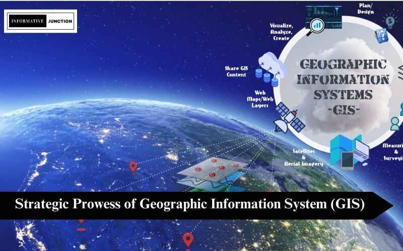
At its core, Geographic Information System (GIS) is a sophisticated framework meticulously designed to capture, store, manipulate, analyze, manage, and present spatial or geographic data. This intricate integration of location-based information with conventional datasets provides an unparalleled lens through which to unravel complex spatial scenarios.
Components of GIS
A resilient GIS ecosystem is built upon a harmonious blend of hardware, software, data, and skilled professionals. From GPS receivers and computers to peripherals, the hardware lays the foundation. Software applications facilitate data processing and analysis, while high-quality data, sourced from satellites, surveys, or existing databases, enriches decision-makers with precise and up-to-date geospatial information.
Applications Across Industries
GIS in Urban Planning
The urban planning landscape undergoes a paradigm shift with the infusion of GIS, optimizing land use, infrastructure development, and resource allocation. City officials and planners harness GIS to visualize growth patterns, identify areas prone to natural disasters, and strategically plan efficient transportation networks to foster sustainable urban development.
Environmental Management and Conservation
The environmental sector leverages GIS to monitor ecosystems, track wildlife migrations, and assess the impact of human activities on biodiversity. Conservation efforts gain significant traction as GIS enables the creation of informed strategies for preserving natural habitats, ensuring a delicate balance between human development and environmental conservation.
Healthcare and Epidemiology
Within the healthcare landscape, GIS plays a pivotal role in mapping disease spread, identifying high-risk areas, and optimizing healthcare resource allocation during outbreaks. This spatial analysis significantly contributes to proactive healthcare management and response strategies, crucial for strategic and effective public health initiatives.
Advantages of GIS
Data Visualization and Interpretation
GIS serves as a transformative tool, converting raw data into captivating visual representations that facilitate a deeper understanding of intricate patterns and relationships. Decision-makers derive valuable insights by visually interpreting maps and spatial data, enabling them to make informed choices based on comprehensive analyses, fostering strategic thinking in various domains.
Improved Decision-Making
The integration of geographical information elevates decision-making prowess across diverse sectors. Whether optimizing supply chain routes, planning disaster response strategies, or identifying market trends, GIS enhances decision-making processes by providing a holistic and spatially aware perspective. Strategic decisions are fortified with a nuanced understanding of the geospatial context, ensuring more effective and sustainable outcomes.
Enhanced Collaboration
GIS fosters collaboration by providing a centralized platform for sharing and analyzing spatial data. This collaborative environment facilitates interdisciplinary communication, ensuring that stakeholders across different fields can seamlessly work together towards common strategic goals. The synergy of diverse expertise results in more holistic and well-rounded strategic solutions.
Future Trends and Innovations
Machine Learning Integration in GIS
A burgeoning trend within the GIS landscape is the seamless integration of machine learning algorithms. This synergy enhances predictive modeling, automates data analysis, and empowers GIS systems to adapt and evolve based on changing patterns and user behavior. The intersection of machine learning and GIS promises more sophisticated and adaptive geospatial intelligence, a cornerstone for future strategic decision-making.
Real-Time Data Analytics
Advancements in technology drive the demand for real-time data analytics within GIS. This capability enables instant decision-making, particularly in dynamic situations such as emergency response or real-time traffic management, where quick and accurate spatial information is paramount. The future of GIS is intricately linked with real-time analytics, ensuring that decision-makers have access to the most current and relevant geospatial data for strategic success.
Challenges and Considerations
Data Quality and Accuracy
Ensuring the quality and accuracy of data remains a paramount challenge for GIS practitioners. Inaccurate information can lead to flawed analyses, potentially resulting in misguided strategic decisions. Rigorous data validation processes are essential to maintain the integrity of GIS-driven insights, safeguarding the accuracy and reliability of strategic information.
Privacy Concerns
The integration of GIS often involves the collection of location-based data, raising legitimate concerns about privacy. Striking a delicate balance between data utilization and individual privacy is an ongoing challenge in the GIS landscape, necessitating robust frameworks and ethical considerations. Addressing privacy concerns ensures that strategic decisions are made responsibly and ethically, aligning GIS practices with societal values.
Conclusion: Navigating the Future with GIS
In conclusion, the indelible impact of Geographic Information System (GIS) spans across diverse industries, acting as a symphony of geospatial intelligence for transformative decision-making. From its foundational components to its expansive applications, GIS continues to redefine our comprehension of spatial data. As we navigate through evolving trends and address challenges, GIS stands resilient at the forefront of technological advancements, unlocking an expansive realm of possibilities for strategic, informed decisions. Harness the unparalleled power of GIS, and chart your course with confidence and precision in an ever-evolving strategic landscape. The symphony of geospatial brilliance awaits, guiding decision-makers towards strategic success in a dynamically changing world.
Read More Informative Blogs on Informative Junction